Mavic 2 Pro Flight on Mt. Lemmon
AIRVŪZ STAFF NOTE :
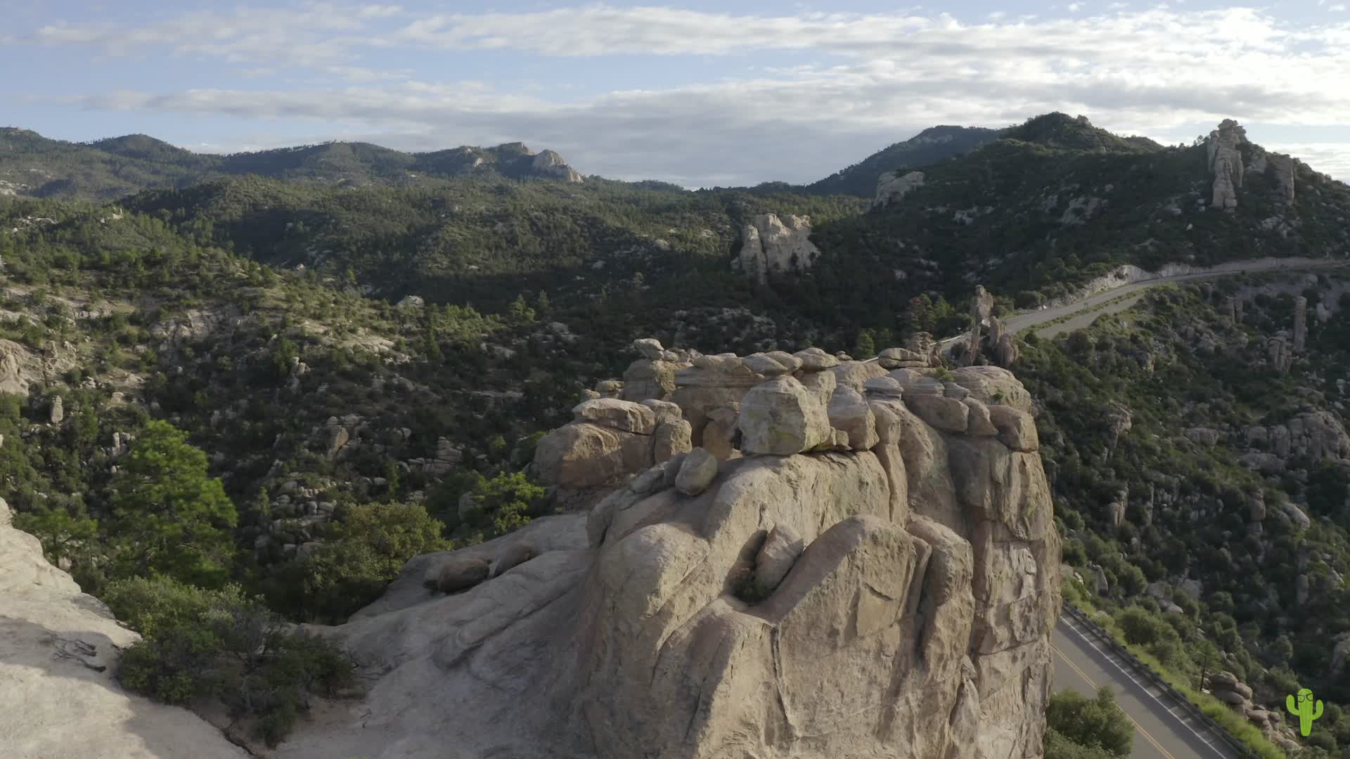
Check out this DJI Mavic Pro 2 drone video of Mt. Lemmon in Tucson, Arizona, compliments of contributor azgeek. It's the highest peak in the Santa Catalina range which runs through the northern part of Arizona's second largest city. The mountain has a peak elevation of almost 2.8k meters (about 9.2k ft.) above sea level, making it one of the highest in the entire Southwestern USA. The mountain hosts a ski resort which reportedly averages about 500 centimeters (200 inches) of snow per year.
- almost 8 years ago
- 1.4k VŪZ
18 


- 19
- Report

BADGES THIS VIDEO HAS EARNED:

Getting to learn the Mavic. This is my first flight out in the wild and I was trying out some of the features on this new drone.
Up Next
Autoplay
Reddington Sunrise

- azgeek
- 1.0k VŪZ
10 - 12
- over 7 years ago
Southern Arizona Phantom 4 Pro March 2017
- azgeek
- 583 VŪZ
15 - 12
- about 9 years ago
Catalina Highway, Tucson, AZ, Phantom 4 Pro
- azgeek
- 1.8k VŪZ
22 - 18
- about 9 years ago
Mavic 2 Pro POI over Picacho Peak
- azgeek
- 1.0k VŪZ
14 - 12
- over 7 years ago
Picacho Peak from Mavic Pro 2
- azgeek
- 744 VŪZ
10 - 9
- over 7 years ago
Sonoran Desert: Saguaro Forest to Owl Head
- azgeek
- 1.6k VŪZ
18 - 13
- about 9 years ago
Ancient Volcanoes
- azgeek
- 1.7k VŪZ
17 - 19
- over 7 years ago
Cathedral Cliff, San Juan County, New Mexico
- azgeek
- 1.4k VŪZ
20 - 16
- almost 7 years ago
Solar Eclipse Trip Aerial Highlights in 4K
- azgeek
- 1.5k VŪZ
20 - 30
- almost 9 years ago
Eroded Landscapes
- azgeek
- 1.2k VŪZ
16 - 19
- over 7 years ago