Picacho Peak from Mavic Pro 2
AIRVŪZ STAFF NOTE :
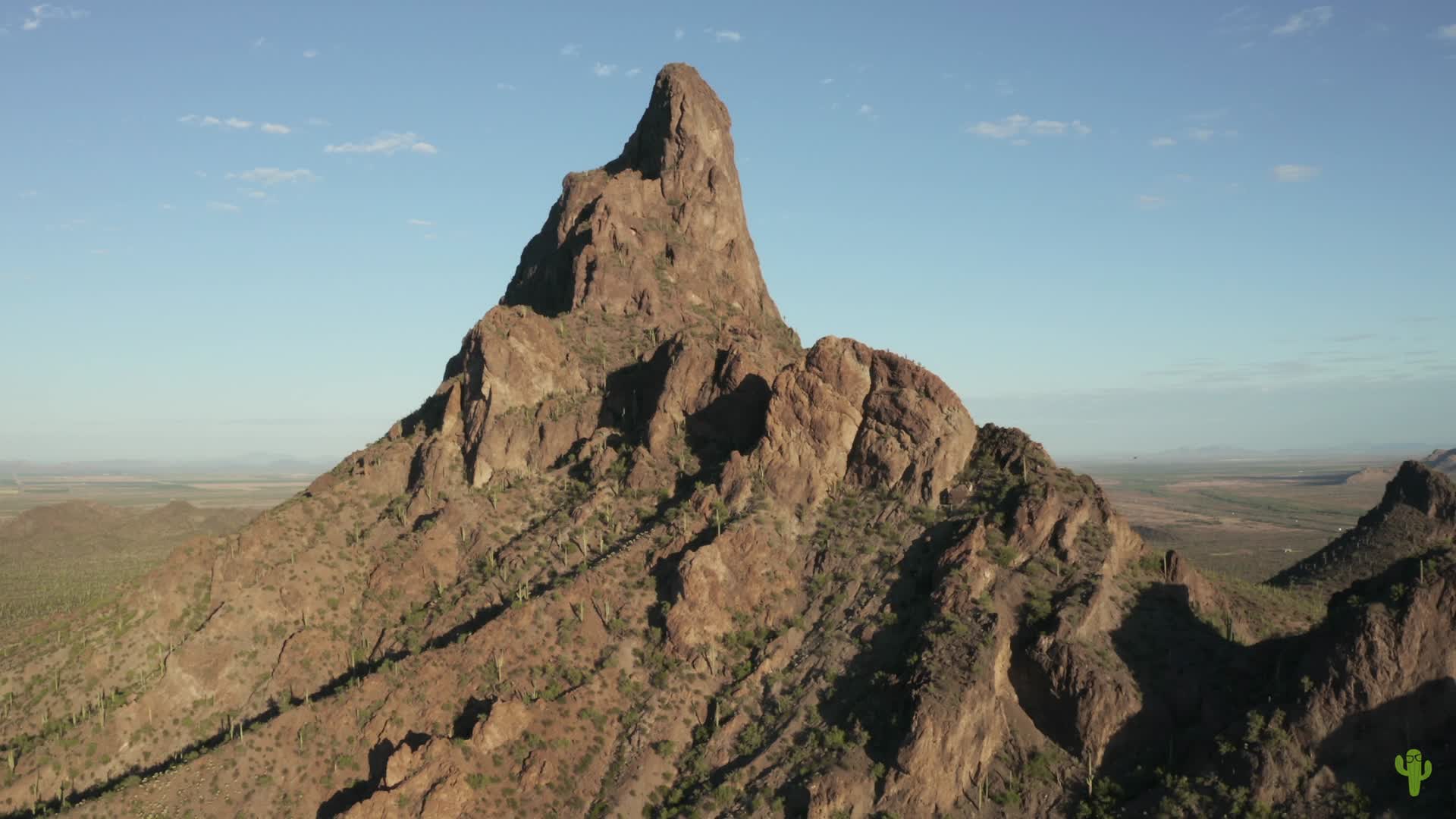
Contributor azgeek used a DJI Mavic Pro 2 drone to create this nice aerial view of Picacho Peak in the USA's southwestern state of Arizona. The centerpiece of a state park of the same name, Picacho Peak is located roughly halfway between Phoenix and Tucson, a bit closer to the latter. the summit has a peak elevation of a little over 1k meters above sea level (just under 3.4k ft.). It's well known for its spring wildflower blossom, as well as its clear views of the vast Sonoran Desert from its western side.
- over 7 years ago
- 745 VŪZ
10 


- 9
- Report

BADGES THIS VIDEO HAS EARNED:

A short reel from some flights over Picacho Peak in Pinal County, north of Tucson, Arizona. I flew from just outside of the park boundaries because drones are prohibited within all (as far as I know) Arizona state parks.
Up Next
Autoplay
Mavic 2 Pro POI over Picacho Peak

- azgeek
- 1.0k VŪZ
14 - 12
- over 7 years ago
Mavic 2 Pro Flight on Mt. Lemmon
- azgeek
- 1.4k VŪZ
17 - 18
- almost 8 years ago
Southern Arizona Phantom 4 Pro March 2017
- azgeek
- 583 VŪZ
15 - 12
- about 9 years ago
Reddington Sunrise
- azgeek
- 1.0k VŪZ
10 - 12
- over 7 years ago
Ancient Volcanoes
- azgeek
- 1.7k VŪZ
17 - 19
- over 7 years ago
VOLCANIC FPV TRIP - Lanzarote

- StArn
- 1.0k VŪZ
23 - 20
- over 8 years ago
Eroded Landscapes
- azgeek
- 1.2k VŪZ
16 - 19
- over 7 years ago
Cathedral Cliff, San Juan County, New Mexico
- azgeek
- 1.4k VŪZ
20 - 16
- almost 7 years ago
Solar Eclipse Trip Aerial Highlights in 4K
- azgeek
- 1.5k VŪZ
20 - 30
- almost 9 years ago
Monument Valley Aerial Views in 4K
- azgeek
- 5.7k VŪZ
63 - 75
- over 8 years ago