Tai Long Wan Hiking Trail in Hong Kong
- over 5 years ago
- 297 VŪZ
8 


- 9
- Report
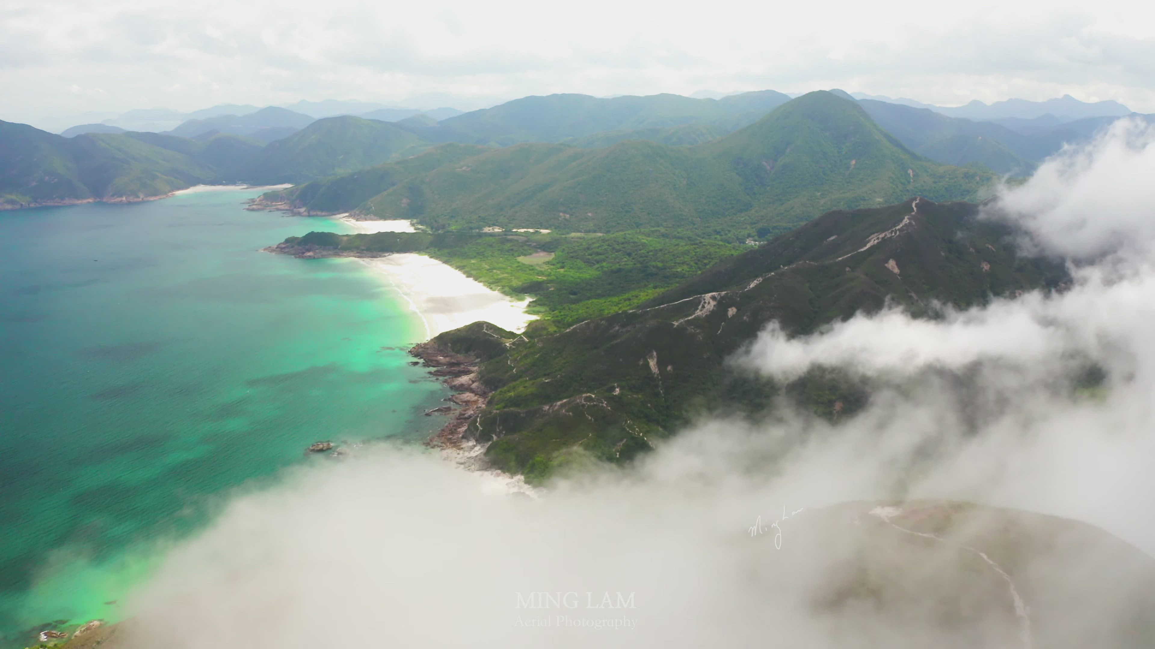
Tai Long Wan Hiking Trail The trail starts at the end of Sai Wan Road. Along this route one will come across a number of scenic bays (e.g. Sai Wan, Chek Keng) and hills (e.g. Sharp Peak, Tai Mun Shan). Tai Long Wan, in particular, with its lucid water and silvery sand, has ranked top of the “Hong Kong Best Ten Scenic Sites” among visitors. 大浪灣遠足徑 起點位於西貢萬宜水庫西灣亭,經大浪西灣、鹽田、赤徑至北潭凹結束。「大浪灣遠足徑」是一條極受歡迎的遠足路線,沿途可欣賞美麗的自然風光與多種典型的海積地貌(例如:西灣、赤徑),此路徑橫跨了約一億四千多萬年前西貢火山活動時期產生的數套岩層,細心觀察路邊的岩石可發現當中的變化。此路徑較長,只適合有經驗的遠足人士,並在遊覽前做好充分的準備。 建議路線
Up Next
Autoplay
Tai Yue Ngam Teng, Sai Kung, Hong Kong

- FolloMe
- 1.6k VŪZ
21 - 18
- over 8 years ago
Dragons Back

- Wild Hong Kong
- 2.7k VŪZ
24 - 21
- almost 9 years ago
Highest peak in Hong Kong 香港最高峰

- minglam
- 788 VŪZ
7 - 12
- almost 6 years ago
DJI Mavic Pro over Dragon's Back-香港龍脊航拍 2July2017

- Bryant.Drone
- 2.0k VŪZ
19 - 20
- over 8 years ago
Hiking in Hong kong
- minglam
- 799 VŪZ
10 - 12
- about 7 years ago
DJI Mavic Pro over Violet hill - 香港紫羅蘭山航拍 20Feb2017
- Bryant.Drone
- 1.9k VŪZ
24 - 21
- almost 9 years ago
Grassy Hill, Shing Mun Reservoir, Hong Kong
- FolloMe
- 2.0k VŪZ
14 - 17
- over 8 years ago
Hong Kong kowloon peak
- minglam
- 1.8k VŪZ
15 - 10
- over 8 years ago
Hong Kong suicide cliff
- minglam
- 947 VŪZ
21 - 24
- almost 8 years ago
Tsing Ma Bridge FPV & Aerial 香港青馬大橋
- minglam
- 1.4k VŪZ
12 - 17
- about 6 years ago