Post-Hurricane Mapping in Puerto Rico - Global Air Media
AIRVŪZ STAFF NOTE :
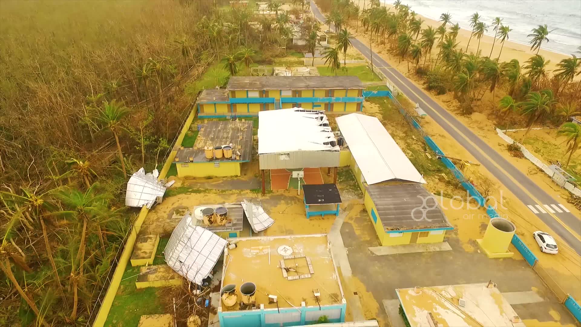
Hurricane Maria devastated large areas around the Caribbean Sea in late 2017. Amongst the hardest-hit areas was the Commonwealth of Puerto Rico, a US territory which bore the brunt of the historic storm. The island saw some of the worst devastations from a natural disaster ever visited on US soil, with over a thousand people killed and some areas enduring months without power. In this video, content creator and drone pilot Global Air Media shows how drone mapping was used in disaster recovery.
- over 8 years ago
- 618 VŪZ
12 


- 7
- Report
BADGES THIS VIDEO HAS EARNED:

A few weeks ago we had a chance to survey some of the devastation in Puerto Rico. There is a long road ahead to recovery but everyday drones are proving to be a practical tool for those efforts. #Dronesforgood #prayforpuertorico
Up Next
Autoplay
Global Air Media 2018 Reel

- GlobalAirMedia
- 2.4k VŪZ
16 - 17
- over 8 years ago
Road Trip to Isabela 4K | Puerto Rico

- Gerald Lizardo
- 3.2k VŪZ
31 - 26
- over 8 years ago
Ellicott City 3D Mapping of Flood Damage
- GlobalAirMedia
- 612 VŪZ
7 - 2
- almost 10 years ago
LONDON (Hyper-lapse Film) by Global Air Media
- GlobalAirMedia
- 1.2k VŪZ
10 - 11
- over 7 years ago
KYRGYZSTAN: by Global Air Media
- GlobalAirMedia
- 3.0k VŪZ
25 - 22
- almost 8 years ago
Castillo San Felipe del Morro, San Juan By Drone | 4K
- Invincible Storm F...
- 1.8k VŪZ
20 - 11
- about 7 years ago
Puerto Rico - Despacito
- AndyOleck
- 5.3k VŪZ
29 - 24
- almost 9 years ago
Simien Mountains - Ethiopia
- GlobalAirMedia
- 2.5k VŪZ
16 - 19
- about 7 years ago
EXPLORING Puerto Rico

- kazukihashiroto
- 10.5k VŪZ
38 - 21
- almost 9 years ago
Vega Baja Beach, Puerto Rico
- Oscar.Alexis
- 4.1k VŪZ
26 - 18
- about 9 years ago