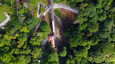
Penang Hill, Malaysia
- over 9 years ago
- 1.3k VŪZ
11 


- 9
- Report
For the federal constituency represented in the Dewan Rakyat, see Bukit Bendera (federal constituency).
Penang Hill
Bukit Bendera, Highest point, Elevation 735 m (2,411 ft)
Coordinates 5°25′28.50″N 100°16′8.08″ECoordinates: 5°25′28.50″N 100°16′8.08″E
Geography
Location Penang Island
Penang Hill is a hill resort comprising a group of peaks in Penang, Malaysia. It is located in Air Itam, which is 6 kilometres (3.7 mi) from the city centre of George Town. Penang Hill is also known by the Malay name Bukit Bendera, which refers to Flagstaff Hill, the most developed peak. The name Penang Hill covers a number of hills, with the highest point at Western Hill which is 833 metres (2,733 ft) above sea level. The hill stands out prominently from the lowlands as a hilly and forested area. It was used as a retreat during the British colonial period, and is now a popular tourist destination in Penang. The top of the hill is accessible via the Penang Hill Railway from its base station at Air Itam
Up Next
Frog Hill | Hidden Gem in Penang | Instagrammable Hill

- babychaix
- 976 VŪZ
13 - 9
- over 3 years ago
Explore the Unexplored | Penang, Malaysia
- JasonJiNz
- 658 VŪZ
0 - 0
- over 4 years ago
Penang Island , Malaysia

- dronedoodle
- 2.4k VŪZ
23 - 21
- about 9 years ago
George Town, Penang Island Malaysia
- dronedoodle
- 1.9k VŪZ
21 - 14
- about 8 years ago
Malaysia Trip 2019

- Drone_Beast
- 718 VŪZ
11 - 7
- almost 5 years ago
Penang First Bridge & Penang Second Bridge aka Sultan Abdul Halim Muadzam Shah Bridge
- babychaix
- 515 VŪZ
4 - 2
- over 3 years ago
Tanjung Bungah , Penang Malaysia
- dronedoodle
- 692 VŪZ
15 - 10
- almost 9 years ago
TRX 106 updates

- Styfly I STUDIO
- 896 VŪZ
14 - 14
- about 7 years ago
2ND WORLD TALLEST SKYSCRAPER YEAR 2020-2021
- Styfly I STUDIO
- 739 VŪZ
10 - 8
- almost 6 years ago
Somewhere , Penang Malaysia
- dronedoodle
- 2.2k VŪZ
27 - 18
- almost 9 years ago