Interested In This Footage?
PUNA
AIRVŪZ STAFF NOTE :
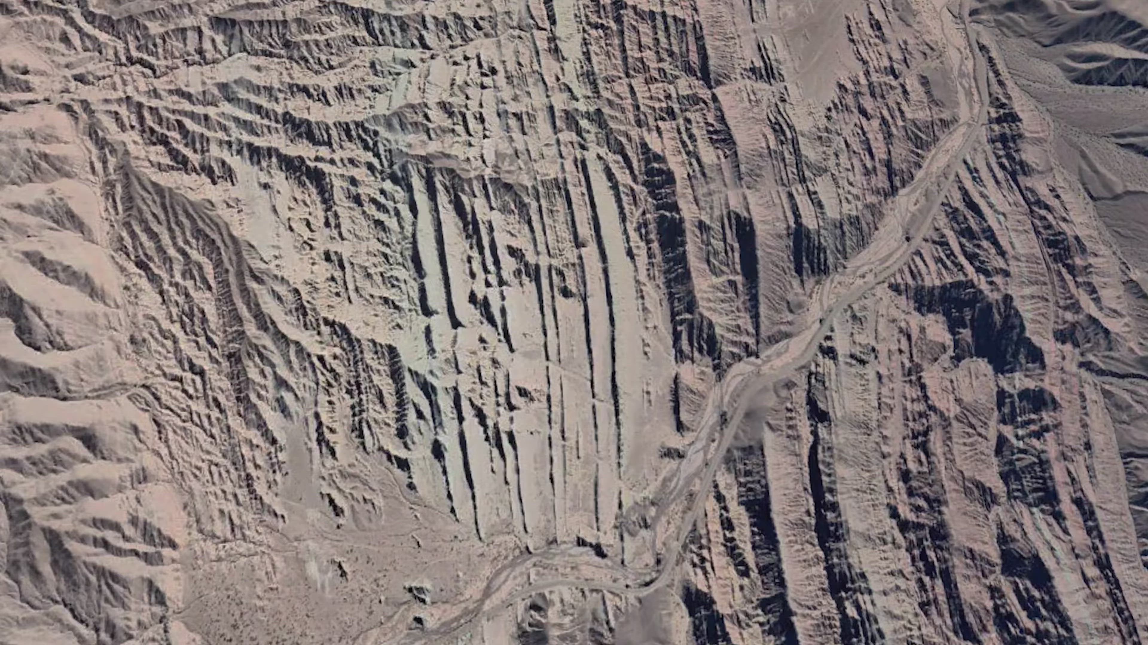
AirVuz contributor and pilot BlackSun brings us this excellent drone video of a plateau of the Andes Mountains in northern Argentina. It's called the Puna de Atacama, and it covers portions of the provinces of Salta, Jujuy, and Catamarca, as well as a small area of neighboring Chile. Covering a massive area of 69k square mi. (around 180k square km), the plateau has an average elevation of almost 15k ft. above sea level (around 4.5k m). It's considered a southern extension of the larger Bolivian Plateau.
- about 4 years ago
- 1.0k VŪZ
9 


- 12
- Report
BADGES THIS VIDEO HAS EARNED:

Las Angosturas es una quebrada angosta que atraviesa la Sierra de Narváez en el departamento Tinogasta a través de la cual fluye el Río Chaschuil. Se trata de una zona montañosa y escarpada por donde se interna la Ruta Nacional 60 y desde donde es posible observar un sin número de geoformas compuestas de diversos materiales y de coloridos muy variados que embellecen el paisaje de una forma maravillosa.
Up Next
Villa Vil Castles

- BlackSun
- 1.1k VŪZ
6 - 9
- about 4 years ago
PunArgentina
- BlackSun
- 2.2k VŪZ
6 - 5
- about 4 years ago
Desierto del Diablo - Salta - Argentina
- BlackSun
- 2.5k VŪZ
15 - 17
- about 4 years ago
THE MOON ON EARTH
- BlackSun
- 1.3k VŪZ
4 - 5
- about 4 years ago
Quebrada las Angosturas
- BlackSun
- 1.3k VŪZ
11 - 11
- about 4 years ago
Antofagasta de la Sierra
- BlackSun
- 1.4k VŪZ
9 - 16
- about 4 years ago
Primeros Pinos
- BlackSun
- 1.2k VŪZ
8 - 12
- almost 3 years ago
DUNE (only red)
- BlackSun
- 810 VŪZ
7 - 5
- about 4 years ago
CONO DE ARITA
- BlackSun
- 1.1k VŪZ
0 - 0
- about 4 years ago
Cono de Arita
- BlackSun
- 1.2k VŪZ
9 - 8
- about 4 years ago