New Zealand - Lake Pukaki and Otago region (Wanaka)
- almost 7 years ago
- 1.0k VŪZ
14 


- 18
- Report

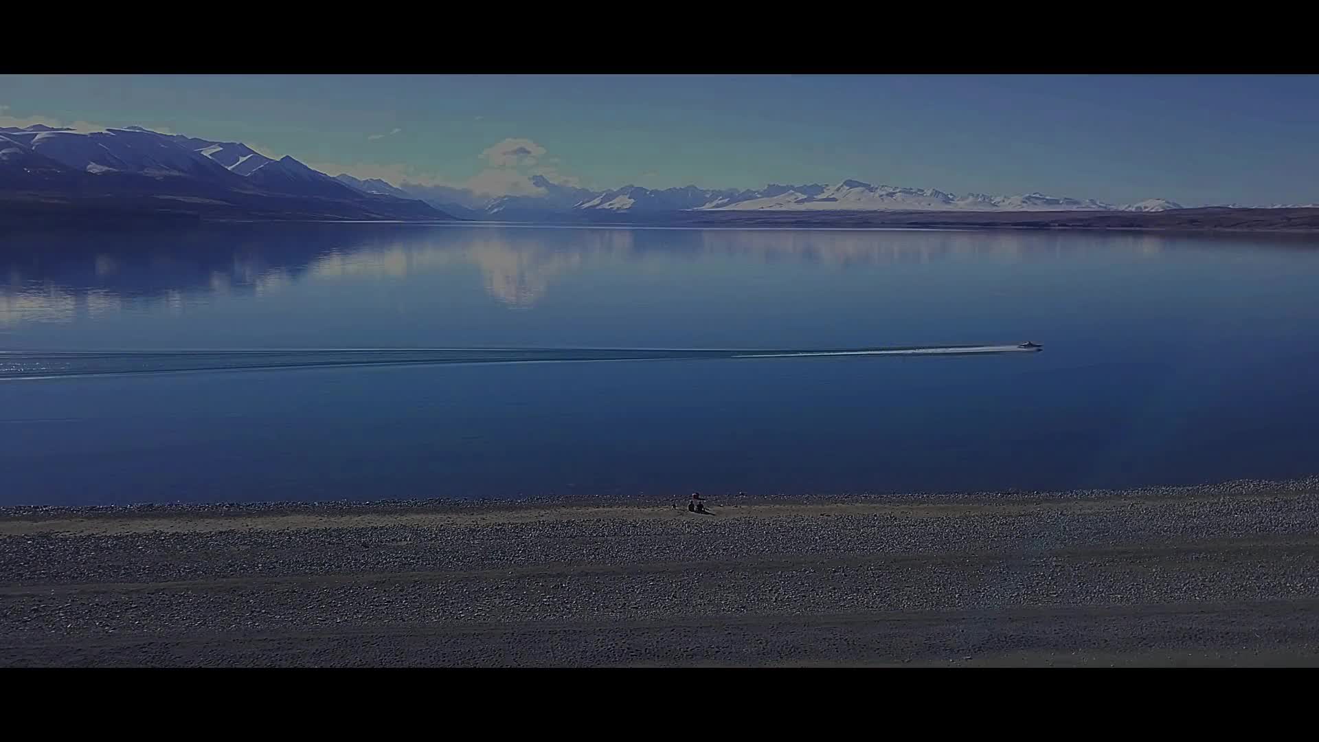
Lake Pukaki is the largest of three roughly parallel alpine lakes running north-south along the northern edge of the Mackenzie Basin on New Zealand's South Island. The glacial feed to the lake gives it a distinctive blue colour, created by glacial flour, the extremely finely ground rock particles from the glaciers. Lake Pukaki covers an area of 178.7 km², and the surface elevation of the lake normally ranges from 518.2 to 532 metres above sea level. The lake is fed at its northern end by the braided Tasman River, which has its source in the Tasman and Hooker Glaciers, close to Aoraki / Mount Cook. Good views of the mountain, 70 kilometres to the north can be had from the southern shore of the lake. ---------------------------------------------------- Wanaka is a popular ski and summer resort town in the Otago region of the South Island of New Zealand. At the southern end of Lake Wanaka, it is at the start of the Clutha River and is the gateway to Mount Aspiring National Park. Travel with passion!
Up Next
South Island New Zealand

- Simonology
- 929 VŪZ
9 - 12
- over 5 years ago
South island, New Zealand

- MavicExplorer
- 1.2k VŪZ
12 - 12
- over 7 years ago
South Island of New Zealand [4K]

- Cameron McGeorge
- 7.6k VŪZ
52 - 58
- about 9 years ago
Lake Tekapo and its surroundings (New Zealand)

- Marmot
- 1.1k VŪZ
16 - 20
- over 6 years ago
New Zealand From Above 4K

- hamzamuj
- 2.6k VŪZ
31 - 21
- about 6 years ago
Rotokakahi, Waikaremoana and Tikitapu lakes (New Zealand)
- Marmot
- 1.6k VŪZ
22 - 32
- over 6 years ago
Lake Emma (New Zealand)
- Marmot
- 1.2k VŪZ
23 - 27
- over 6 years ago
Lake Pukaki, New Zealand

- noeels
- 755 VŪZ
17 - 13
- over 9 years ago
New Zealand - Lake Coleridge
- Marmot
- 1.1k VŪZ
13 - 12
- almost 7 years ago
New Zealand from Above

- AirVūz Social
- 1.7k VŪZ
4 - 3
- almost 3 years ago