Nevado de Toluca
AIRVŪZ STAFF NOTE :
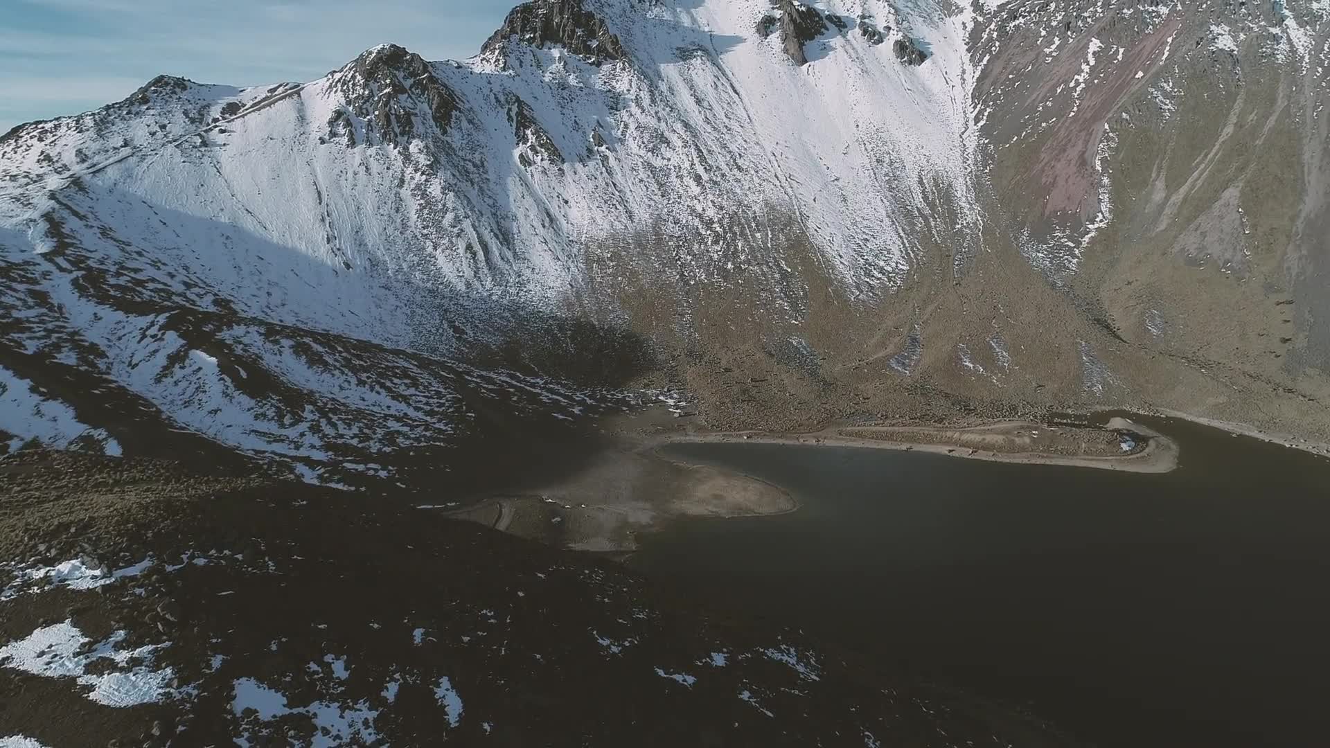
One of Mexico's most important geographical features is the Trans-Mexican Vocanic Belt, which (as the name suggests) is a line of (mostly active) volcanoes which cuts across the width of the south-central part of the country and is home to some of the highest mountains in North America. The fourth-tallest of these mountains, and the subject of this beautiful drone video, is Nevado de Toluca. This now-dormant stratovolcano has a peak elevation of almost 4.7k meters or just over 15.3k ft. above sea level.
- over 6 years ago
- 1.4k VŪZ
22 


- 19
- Report

BADGES THIS VIDEO HAS EARNED:

Este vuelo se realizó en la laguna del crater del nevado de Toluca poco después del amanecer, fueron 2 materias las que utilice.
Up Next
Autoplay
Nevado de Toluca “Xinantecatl” Mexico
- Nomade World
- 1.6k VŪZ
24 - 12
- over 8 years ago
The Best of Mexico Explored from Above
- AirVūz Social
- 1.4k VŪZ
9 - 7
- about 4 years ago
Vibrant and Iconic Mexico, Explored from Above, Part 1
- DroneTV: Powered b...
- 1.3k VŪZ
0 - 1
- about 1 month ago
Mexico Drone Video Compilation

- DroneTV: Powered b...
- 655 VŪZ
2 - 0
- over 4 years ago
La Puna de Atacama - Atacama Desert - Chile 4k

- nuclearcl
- 1.8k VŪZ
15 - 16
- almost 7 years ago
Nevado de Colima Mexico

- laloggilling
- 1.0k VŪZ
18 - 9
- over 10 years ago
Hiking Nevado del Tolima - Favorite Places

- la.drones
- 1.1k VŪZ
20 - 14
- over 8 years ago
Farellones and La Parva Ski Resort - El Colorado - Chile
- TakingOff
- 1.1k VŪZ
12 - 14
- over 6 years ago
Road to the Mountain - Drone View
- MSR
- 1.9k VŪZ
31 - 20
- over 8 years ago
Drone Faro de Arico 🇮🇨

- Manuel Armas
- 1.2k VŪZ
2 - 1
- about 4 years ago