Nansha [ III ] - Aerial View of Guangdong Province, China
- over 7 years ago
- 6.5k VŪZ
24 


- 17
- Report

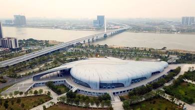
Nansha District, Guangzhou, Guangdong. Located at the southernmost end of Guangzhou and on the West Bank of Humen Waterway of Pearl River, it is the convergence place of Xijiang, Beijiang and Dongjiang rivers; facing Dongguan across the river in the east; bordering Zhongshan City and Shunde District of Foshan City in the west; connecting with Panyu District of Guangzhou with Shawan Waterway in the north; and lining up with Lingdingyang District at the mouth of the Pearl River in the south. Located at the Pearl River estuary and the Geographic Geometry Center of the Great Pearl River Delta, it is a passage to the sea from the Pearl River Basin, a hub connecting the Pearl River Port Urban Agglomeration, and the only passageway for Guangzhou to go to sea, 38 nautical miles from Hong Kong and 41 nautical miles from Macau.
Up Next
Nansha [ II ] - Aerial View of Guangdong Province, China

- Droneland
- 2.8k VŪZ
32 - 17
- over 7 years ago
Shekou - Aerial View of Guangzhou Province
- Droneland
- 5.9k VŪZ
50 - 38
- over 7 years ago
Conghua - Aerial View of Guangzhou Province
- Droneland
- 3.4k VŪZ
33 - 17
- over 7 years ago
Nansha [ I ] - Aerial View of Guangdong Province, China
- Droneland
- 7.1k VŪZ
30 - 14
- over 7 years ago
Panyu - Aerial View of Guangdong Province, China
- Droneland
- 1.6k VŪZ
6 - 4
- about 3 years ago
Dongguan - Aerial View of Guangzhou Province
- Droneland
- 4.5k VŪZ
31 - 17
- about 7 years ago
Zhuhai - Aerial View of Guangzhou Province
- Droneland
- 3.0k VŪZ
29 - 20
- about 7 years ago
Shenzhen [ III ] - Aerial View of Guangdong Province, China
- Droneland
- 2.9k VŪZ
27 - 16
- over 7 years ago
Foshan - Aerial View of Guangzhou Province
- Droneland
- 3.0k VŪZ
26 - 12
- about 7 years ago
Shenzhen [ II ] - Aerial View of Guangdong Province, China
- Droneland
- 2.6k VŪZ
46 - 36
- almost 8 years ago